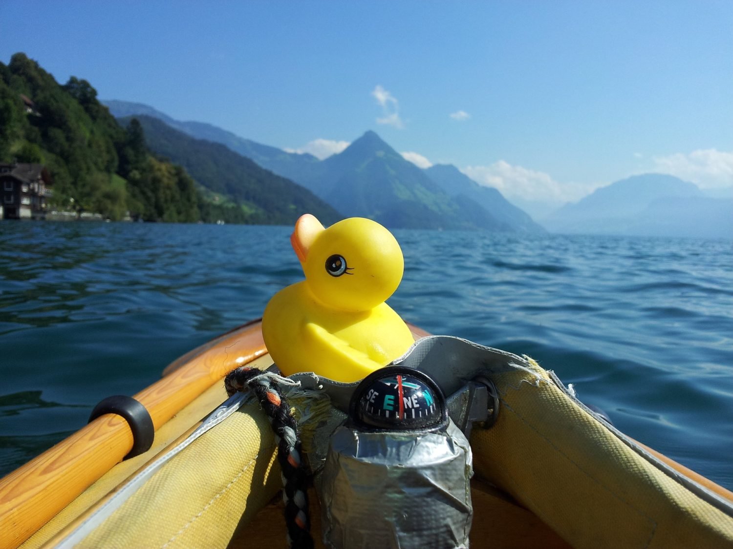
One of the best parts about owning a kayak is getting to explore places you never thought possible. One of the worst parts — if you don’t own a good kayak navigation GPS system — is not knowing how to get back out.
In the days of LTE and 4G data speeds, it can be tempting to think a smartphone is all you need for kayak navigation. Out in the wilderness, though, there aren’t usually an abundance of cellphone towers, and it’s not worth taking the chance.
The best kayak GPS devices offer a lot more to the intrepid paddler than a cellphone ever could, anyway. With offline maps, waterproof touchscreens and world-class (literally) navigation — not to mention kayak GPS fishfinders, water maps and longer battery life — these devices are built with adventuring in mind.
The Best GPS for Kayaks – American Paddler’s Reviews
Garmin is generally recognized as the leader in GPS technology, so most of our recommendations reflect this. Our kayak GPS reviews are organized in four categories: fishfinder GPS combos, budget kayak GPS units, midline units and high-end devices.
- Best Kayak GPS Fishfinder Combos: Garmin Striker 4 GPS Fishfinder and Humminbird Helix 5 CHIRP Di GPS G2 Fishfinder
- Best Budget Kayak GPS Systems: Garmin eTrex 10 Worldwide Handheld GPS and Magellan Triton 500
- Best GPS for Kayak Navigation: Garmin GPSMAP 78sc Waterproof Marine GPS and Chartplotter and Garmin eTrex 30x
- Best High-End Kayak GPS Systems: Garmin Montana 680t and Garmin Oregon 750t
A QUICK RUNDOWN: THE BEST GPS FOR KAYAKS IN 2021 (CLICK LINKS BELOW TO SEE LATEST PRICES ON AMAZON.COM)
| PHOTO | GPS | SATELLITES* | BEST FOR | FEATURES |
|---|---|---|---|---|
 | Garmin Striker 4 GPS Fishfinder | GPS | Variety of fishing environments (freshwater or saltwater) | 1,600-foot depth, sonar history, fishing hotspots |
 | Humminbird Helix 5 CHIRP Di GPS G2 Fishfinder | GPS | Daytime, dusk or night fishing | 5-inch HD Switchfire display, custom map charting |
 | Garmin eTrex 10 Worldwide Handheld GPS | GPS, GLONASS | Budget (accuracy) | 25 hour battery life, solid basic navigation |
| Magellan Triton 500 | GPS | Budget (user-friendliness) | Color display, compass, barometer | |
 | Garmin GPSMAP 78sc Waterproof Marine GPS and Chartplotter | GPS | Marine-specific navigation | Built-in watermaps and coastal charts, device itself floats |
 | Garmin eTrex 30x | GPS, GLONASS | Solid, versatile and accurate all-around kayak GPS | High-detail maps, 25 hour battery life, better accuracy |
 | Garmin Montana 680t | GPS, GLONASS | High-end GPS w/satellite images, camera | Image geotagging, preloaded TOPO maps, 8-megapixel camera, dual-orientation touchscreen |
 | Garmin Oregon 750t | GPS, GLONASS | High-end GPS with satellite images, camera and Internet connectivity | Image geotagging, preloaded maps, dual-orientation touchscreen, weather radar and Internet connectivity |
How to Choose the Best Kayak GPS
Most kayak GPS units have standard features such as basemaps, the ability to set waypoints and save favorite locations. However, there are some key differences to watch out for.
Made for Water?
All of the kayak GPS reviews on our list are waterproof to IPX7 specifications — which means they’re resistant to splashes, rain or even immersion up to 1 meter for 30 minutes. However, some offer extra marine-specific features, such as:
- Built-in fishfinders
- Marine cartography maps including shorelines, coastal charts, depths, harbors and marinas (or the ability add such maps)
- The ability to float
- Mountable backings for use with kayak gear tracks
Battery life can be important, too, when out on the water, and a backlit, sunlight-readable display can help when shade or cloud cover can’t be found. A few units even offer weather updates.
Navigation speed and accuracy
GLONASS and GPS: Whenever possible, look for a kayak GPS device that features GLONASS support in addition to a standard high-sensitivity GPS receiver. Standard U.S.-based GPS technology relies on 31 satellites to track location. However, some GPS devices can be paired with GLONASS, a Russian-based satellite system that tracks 24 additional satellites — greatly increasing your device’s speed and accuracy.
HotFix satellite prediction: Another great feature on some GPS units is HotFix, a technology that greatly speeds up loading times by allowing your device to “predict” the location of satellites based on data collected over a period of days.
Compass and Barometer: Some of the best kayak GPS devices also come with built-in electronic compasses and barometric altimeters, which can detect both changes in the weather as well as your elevation. Both are handy kayak navigation tools if you’re paddling in mountainous or remote areas.
Mapping and Tracking
Course charting and waypoints: If you’ll be using your GPS as a sea kayak navigation aid — or paddling any kind of long distance — the ability to chart your course and plot waypoints is critical. Not only does this allow you to find your way back, but your GPS can also help you track your speed so you can predict arrival times.
Adding maps: Most units come with a built-in basemap (usually covering North America or worldwide), but depending on your needs, it may be worth it to invest in additional maps. Some maps that are commonly available include topographical maps, coastal charts, city (road) maps, hunting maps and satellite images. It’s important to make sure your GPS can support additional maps, either via an SD card or the unit’s memory itself. This is especially important if you’ll be using your GPS for multiple purposes.
Additional features
If you’re looking for more than just simple kayak navigation, some GPS devices come with additional bells and whistles, such as:
- Paperless geocaching with automatic downloads
- Wireless Internet and Bluetooth connectivity for emails, apps and text alerts
- Built-in digital cameras to allow you to geotag locations with images
If you’ll be mounting your GPS on your kayak, pay attention to screen size, too. Larger screens will be more easily readable from the cockpit.
Best Kayak GPS Fishfinder Combos
Garmin Striker 4 GPS Fishfinder

![]() Why You Want It: High visibility fishfinder at varying depths, marking fishing hotspots and routes, accurate fish IDs, easily manageable size
Why You Want It: High visibility fishfinder at varying depths, marking fishing hotspots and routes, accurate fish IDs, easily manageable size
Water resistant: Yes (IPX7)
Display: 3.5-inch color
Fishfinder: CHIRP (77/200 kHz) sonar transducer; transmit power (200 W RMS)/(1,600 W peak-to-peak); dual-frequency and dual-beam sonar capable
Maximum depth: 1,600 feet freshwater, 750 feet saltwater
Mapping: Scrolling sonar history; mark fishing hotspots, docks and waypoints
Coverage: Built-in, high-sensitivity GPS
Extra features: On-screen speed checker; built-in flasher for stationary (vertical) fishing; easy keypad operation; audible alarms; tilt/swivel mount
For a budget kayak fishfinder, the Garmin Striker 4’s CHIRP sonar transducer and high-detail color display make a world of difference for kayak anglers. Unlike standard 77/200 kHz transducers, Garmin’s CHIRP technology sends multiple sonar frequencies to provide a higher level of detail and clarity to let you see exactly what’s below — even at varying depths (up to 1,600 feet in freshwater).
Anglers can use the built-in GPS to mark locations and waypoints where the fish are plentiful, as well as docks and starting points to get there quickly — something other budget fishfinders can’t do. And with scrolling sonar history, you can easily go back to see what you’ve missed. Garmin’s Fish Symbol ID even helps identify the type of fish you’re dealing with.
The 3.5-inch color display is easily readable without squinting, with speed, water temperature and vertical fishing flashers displayed right on the unit. A swivel mount and easy keypad operation make it perfect for mounting on kayak gear tracks, too.
Humminbird Helix 5 CHIRP Di GPS G2 Fishfinder

![]() Why You Want It: Larger, backlit display for sunlight and nighttime visibility, custom map charting, navigating to fishing hotspots
Why You Want It: Larger, backlit display for sunlight and nighttime visibility, custom map charting, navigating to fishing hotspots
Water resistant: Yes (IPX7)
Display: 5-inch backlit HD color with SwitchFire display
Fishfinder: CHIRP digital DualBeam PLUS and down-imaging sonar transducer; power output (500 W RMS)/(4,000 W peak-to-peak); SmartStrike shows where the fish are biting
Maximum depth: 600 feet (upgraded transducer can measure 2,500 feet)
Mapping: Chartplotting with built-in UniMap cartography covering contiguous U.S. lakes, rivers and coastlines; micro SD slot for additional maps or saving waypoints; AutoChart Live to track uncharted waters
Coverage: Precision internal GPS tracking
Extra features: Speed tracking; selective fish ID; large digits with split screen; water temperature alerts; custom digital readouts
A quality GPS fishfinder at a very good price, Humminbird’s Helix 5 offers a boatload of technology for serious kayak anglers. Dual-beam sonar and down-imaging technology let you scan a wide area to see where the fish are, or scan right below your boat for high accuracy and bottom visibility.
One of the best features for kayak anglers is this GPS fishfinder’s brightly lit, 5-inch HD display. Backlit for excellent visibility in both sunlight and at dusk, it also features Humminbird’s SwitchFire monitor, which allows anglers to control how the unit displays sonar images — either in clean mode (showing just the fish) or max mode, which displays a full sonar picture. Despite the large display, the unit still includes analog buttons for easy operation.
The precision internal GPS lets you chart courses and fishing spots — which is made easier thanks to built-in watermaps of U.S. rivers, lakes and coastlines. For venturing into uncharted waters, there’s Humminbird’s AutoChart Live feature, which makes a map as you go. And Humminbird’s SmartStrike technology helps you find where — and what kind — of fish are out there.
For the price, this is without a doubt one of the best kayak GPS fishfinder combinations out there.
Best Budget Kayak GPS Systems
Garmin eTrex 10 Worldwide Handheld GPS

![]() Why You Want It: GLONASS compatibility (for faster and more accurate satellite reception), worldwide map, geocaching support, longer battery life
Why You Want It: GLONASS compatibility (for faster and more accurate satellite reception), worldwide map, geocaching support, longer battery life
Waterproof: Yes (IPX7)
Display: 2.2-inch monochrome
Battery life: Up to 25 hours
Mapping: Worldwide basemap; memory for 1000 waypoints, 50 routes
Coverage: WAAS-enabled receiver; GPS and GLONASS satellites; HotFix satellite prediction for faster loading times
Extra features: Paperless geocaching support; sun and moon data; hunting/fishing calendar; spine-mounting support
For a basic, budget kayak GPS device, the Garmin eTrex 10 offers exceptional accuracy. For the price, the fact that it includes HotFix and GLONASS support — offering 24 additional satellites for faster and more accurate readings — is a huge plus.
With a preloaded basemap and the ability to track waypoints and altitude, this GPS has all the basics of kayak navigation covered. The eTrex 10 lasts for 25 hours on a pair of AA batteries, and can be used with spine-mounting Garmin accessories to attach to your kayak. It’s also a great geocaching GPS, offering paperless support through OpenCaching.com.
With rugged exterior for outdoor use, the unit is waterproof for worry-free kayaking. Though it doesn’t have a color display, it does have an easy-to-use interface and side buttons for quick power-on, lighting control and menu items.
Magellan Triton 500
Why You Want It: Color display, compass and barometer for weather and elevation tracking, ability to add maps
Waterproof: Yes (IPX7)
Display: 2.2-inch color
Battery life: Up to 12 hours
Mapping: Basemap of U.S. (excluding Hawaii) and Canada; worldwide geographic boundaries; ability to add marine cartography and topographic maps (including National Geographic TOPO! State and Weekend Explorer 3D) via SD card
Coverage: WAAS-enabled GPS receiver; 3-axis electronic compass; barometer for weather forecasting and elevation accuracy
Extra features: Sun and moon data; hunting/fishing calendar; audible proximity alarms
A slight step up from the Garmin eTrex 10 for user-friendliness is the Magellan Triton 500, which features a color display and additional features such as a barometer and internal compass.
Though the Magellan’s compass and barometer let you track weather patterns and direction, the Triton does not feature GLONASS support, like the eTrex does. However, unlike the eTrex, the Triton does allow you to add maps (via microSD) for a higher degree of versatility. It also displays sunrise and moonrise times, a hunting and fishing calendar and audible alerts.
If display and readability is most important to you in a budget kayak GPS system, the Triton is probably the better option. If, however, you prefer better accuracy and battery life, go with the eTrex 10.
Best GPS for Kayak Navigation
Garmin GPSMAP 78sc Waterproof Marine GPS and Chartplotter
![]() Why You Want It: Built-in watermaps and coastal charts, floating device designed for watercraft
Why You Want It: Built-in watermaps and coastal charts, floating device designed for watercraft
Waterproof: Yes (marine-grade IPX7); device also floats
Display: 2.6-inch color
Battery life: Up to 20 hours
Mapping: Worldwide basemap; includes U.S. and Bahamas coastal charts (Bluechart g2) with shorelines, depth contours, harbors and marinas; ability to add maps via microSD card and 1.7GB internal memory
Coverage: High-sensitivity WAAS-enabled GPS receiver with HotFix quick-loading satellites; built-in 3-axis tilt-compensated electronic compass; barometric altimeter for altitude tracking and weather monitoring
Extra features: Supports BirdsEye Satellite Imagery (subscription needed); Custom Maps (to scan paper maps); paperless geocaching; turn-by-turn navigation for roads
Specifically designed for watersports use, the Garmin GPSMAP 78sc is a step up from the basic options for kayak navigation. The first thing paddlers will appreciate is the built-in Bluechart g2 U.S. coastal maps that show depth visibility, harbors, marinas, lakes and coastlines in high-contrast color. Besides being waterproof, the device also floats.
In addition to the coastal charts, the GPSMAP 78sc has the ability to add roadmaps and topographical maps via microSD, as well as BirdsEye satellite imagery — making this a great GPS for any use, including hiking, hunting and automobile navigation. It even offers geocaching support and wireless sharing of waypoints and routes.
The GPSMAP 78sc doesn’t offer GLONASS support, but it does feature HotFix technology for quicker load times, as well as a compass and barometer for a higher degree of accuracy. The barometer also allows you to monitor changing weather in real time, a nice feature for touring kayakers.
Garmin eTrex 30x

![]() Why You Want It: High-detail maps, longer battery life, more memory and better satellite accuracy
Why You Want It: High-detail maps, longer battery life, more memory and better satellite accuracy
Waterproof: Yes (IPX7)
Display: 2.2-inch 65K color (sunlight-readable)
Battery life: Up to 25 hours
Mapping: Worldwide basemap with shaded relief; large 3.7GB internal memory to add topography (TOPO 24K), hunting (Garmin HuntView), water (BlueChart g2) and city (City Navigator NT) maps; supports BirdsEye Satellite Imagery (subscription-based); microSD compatible
Coverage: WAAS-enabled GPS receiver with GLONASS compatibility and HotFix quick-loading satellites; 3-axis compass; barometric altimeter for altitude tracking and weather monitoring
Extra features: Handheld or mountable; paperless geocaching; BaseCamp trip-planning software; easy power, menu and light buttons; wireless connectivity to other Garmin devices
If you’re looking at mid-tier kayak GPS navigation devices, the Garmin GPSMAP 78sc holds an edge over the Garmin eTrex 30x for initial, water-specific features. However, the eTrex 30x is faster, more accurate and has a better display.
This is in large part thanks to its GLONASS compatibility, which gives the 30x access to 24 additional satellites — a huge upgrade in terms of performance. Like the 78sc, it also features HotFix satellite prediction and a compass and barometer.
Though it doesn’t come with preloaded water maps, the eTrex 30x certainly has the ability to add them, thanks to its 3.7GB internal memory and microSD compatibility. You can also add topographical, hunting, city or satellite maps.
Where the eTrex 30x really shines (no pun intended) is its high-resolution color display, which is readable in sunlight and shows speed, elevation and compass direction in vivid color. Like the base models, the eTrex 30x also comes with geocache support.
Best High-End Kayak GPS Systems
Garmin Montana 680t

![]() Why You Want It: Free satellite images for 1 year, dual-orientation touchscreen and 8-megapixel camera
Why You Want It: Free satellite images for 1 year, dual-orientation touchscreen and 8-megapixel camera
Waterproof: Yes (IPX7)
Display: 4-inch dual orientation 65K color (glove friendly and sunlight readable)
Battery life: Up to 16 (lithium ion) or 22 hours (AA batteries)
Mapping: Worldwide basemap; preloaded TOPO U.S. 100K maps; includes 1-year BirdsEye Satellite Imagery subscription; add water (BlueChart g2), city (City Navigator NT) and custom maps via microSD and 8GB memory
Coverage: WAAS-enabled GPS receiver with GLONASS compatibility and HotFix quick-loading satellites; 3-axis compass; barometric altimeter for altitude tracking and weather monitoring
Extra features: 8-megapixel digital camera with BaseCamp image geotagging; dual battery system; turn-by-turn navigation; mountable backing; paperless geocaching (via uploads from GeoCaching.com)
For those who want it all, the Garmin Montana 680t is a full-featured kayak GPS that offers excellent satellite accuracy and tracking along with an 8-megapixel camera and brilliant color display.
The 4-inch 65K color touchscreen is glove-friendly, sunlight-readable and offers dual orientation — meaning you can hold it in landscape or portrait mode — giving you a variety of mounting or handheld options. It also comes pre-loaded with TOPO U.S. 100K maps and a 1-year subscription to the BirdsEye Satellite Imagery service — a very nice bonus.
So, why does a GPS unit need a camera? Because unlike your smartphone, your GPS can geotag the locations where you saw certain things. Need to remember where a certain river bend or sandbar was? Take a picture and tag it. This is also a nice geocaching feature.
Like other high-end Garmin models, the Montana offers GLONASS support for greater satellite accuracy and load times, and features HotFix, a digital compass and barometric altimeter to track elevation and weather changes.
Unlike most GPS units, the Montana offers a dual-battery option — a lithium-ion battery (not included) with 16 hours of life or AA batteries offering up to 22 hours. This makes it a nice option for longer trips.
If you find you don’t need the 8GB of internal memory, try the Montana 610t instead, which comes with 4GB of memory and a cheaper price tag. Both units are microSD compatible to add roadmaps and coastal charts.
Garmin Oregon 750t
![]() Why You Want It: Internet connectivity, weather radar maps and pinpoint accuracy
Why You Want It: Internet connectivity, weather radar maps and pinpoint accuracy
Waterproof: Yes (IPX7)
Display: 3-inch dual orientation color touchscreen (sunlight readable)
Battery life: Up to 16 hours
Mapping: Worldwide basemap; preloaded TOPO U.S. 100K maps; includes 1-year BirdsEye Satellite Imagery subscription; add water (BlueChart g2), city (City Navigator NT) and custom maps via microSD and 4GB memory
Coverage: Improved antenna with WAAS-enabled GPS receiver with GLONASS compatibility and HotFix quick-loading satellites; barometric altimeter for altitude tracking and weather monitoring; TracBack feature to find way back to starting point along same path
Extra features: See emails, texts and download apps on your GPS device with multilink wireless connectivity (WiFi, Bluetooth and ANT+); active weather support with animated radars; 8-megapixel autofocus camera with image geotagging; paperless geocaching (via automatic uploads from GeoCaching.com); calorie tracking; chartplotting and sharing with BaseCamp software
Take the Montana 680t and add Internet connectivity, a better antenna for even greater coverage and live weather radar maps, and you’ve got the Garmin Oregon 750t. Built specifically for outdoor use while hiking, hunting, climbing or kayaking, this rugged device is designed to offer the outdoor adventurer everything they’ll need.
One of the nicest parts about the Oregon is the ability to see Active Weather alerts, which overlays a weather radar over your map for real-time monitoring. With WiFi, Bluetooth and ANT+ wireless connectivity, you can even get texts, emails and download apps right to the device, as well as share routes and waypoints with other users via the built-in BaseCamp software.
Like the Montana, the Oregon features an 8-megapixel camera for geotagging images, and comes preloaded with TOPO U.S. 100K maps and a 1-year BirdsEye Satellite Imagery subscription. For the avid geocaching enthusiast, the device can be configured to automatically download caches from GeoCaching.com.
As far as satellite tracking goes, the Oregon offers an upgraded antenna with GLONASS support and HotFix, meaning you’ll always get the quickest load times and highest accuracy possible. It also has a compass and barometric altimeter, which is to be expected for a high-end device. One cool navigational feature is the TracBack technology, which allows you to chart a waypoint or route and direct your GPS device to route you back the same way you came.
The Oregon’s 3-inch sunlight-readable display is dual-orientation (portrait or landscape). Though there aren’t a ton of differences between the 750t and the Oregon 650t, the 750t has a swipe left/right touchscreen menu and easier user interface.
One possible drawback is a limited battery life, though you can use either AA batteries or the rechargeable NiMH power pack.